• News
  • 26 June, 2013
Share

Refreshed Satellite imagery being pushed out for Google Maps and Earth

Google Maps and Earth
Google is updating all of its satellite images that a person can view on Google Maps and Google Earth today. The new images feature cloud-free images from space that it says  “includes refreshed imagery for regions of the world where high-resolution imagery is not yet available, and offers a more comprehensive and accurate view of the texture of our planet’s landscape.”

With the Blue Marble as inspiration, we used Google Earth Engine technology to mine hundreds of terabytes of data from the USGS’s and NASA’s Landsat 7 satellite. The result is a seamless, globally-consistent image of the entire planet with a resolution of 15 meters per pixel, far finer than is possible with MODIS data alone.

I don’t know about you guys, but I spend a whole lot of hours cruising around satellite imagery on both my Galaxy S3 and PC often. Looking at cool places that I’d love to visit, checking surrounding areas where I’ll be camping for a few days and often times just marveling at the how cool our little space rock really is.
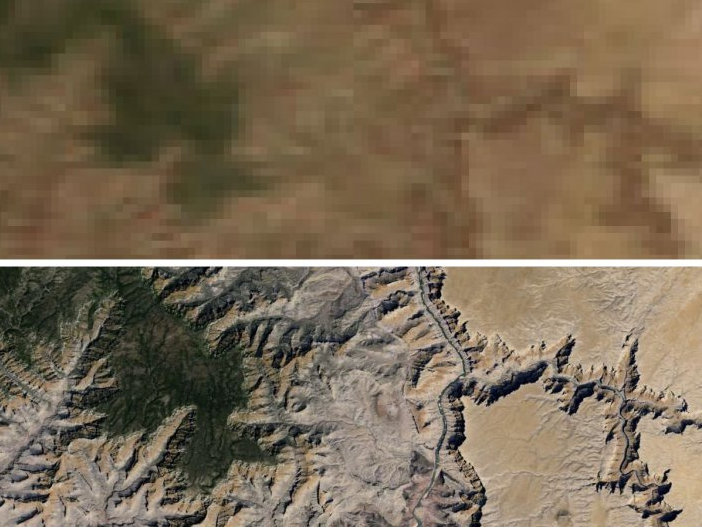
Google Maps Satellites
The update is on Google’s side, so there won’t be a need to make any app updates. However, if you haven’t played about with Google Earth on your Android device, the link is down below. It is pretty cool.

Google Earth Play Store link

Via 9to5Google